

Met Office snow warning in place across Badenoch and Strathspey after further wintry weather hits the Highlands
Register for free to read more of the latest local news. It's easy and will only take a moment.

A SNOW warning remained in force for parts of the Highlands this morning after the Met Office issued a yellow alert overnight.
The warning, which runs until 11am, was issued after a band of snow, sleet and rain pushed in from the north overnight – bringing snow even down to sea level in some areas in the early hours before turning back to sleet and rain.
Higher areas have continued to see snow, such as the A9 at the likes of Daviot, Slochd and Drumochter.
A Met Office spokesman said: "An area of snow and rain currently extending southwards from the Highlands and Grampians to reach the Central Belt towards dawn, will turn more showery in nature by mid to late morning as snow level becomes confined to highest roads. Snow accumulations of snow up to three centimetres below 150m and six centimetres over higher roads is possible."
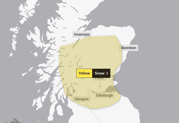
The area covered by the yellow warning extends from just south of Inverness, down through Badenoch and Strathspey, and on into the Central Belt.