

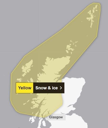
Snow and ice yellow warning issued for Highlands by Met Office
Register for free to read more of the latest local news. It's easy and will only take a moment.

Several inches of snow could bring transport disruption to the Highlands overnight tonight, the Met Office has warned.
It issued a yellow weather warning this morning (Tuesday) which comes into force at 3pm and will remain in place until midday on Wednesday.
The alert covers large swathes of the Highlands and Islands.
A Met Office spokesperson has warned that showers will bring 1-3cm of snow "quite widely" but possibly "another 5-8cm in the north-west" as a band of showers moves into cold air from the west.
"Snow showers, mainly affecting northern Scotland on Tuesday afternoon and evening, will extend further south to reach some other parts of Western and Central Scotland overnight into Wednesday morning.
"Accumulations of 1-3cm are likely quite widely across the warning area, with perhaps another 5-8cm over the Northwest Highlands. Icy surfaces will be an additional hazard, following the recent wet weather."
The full warning area covers all of Caithness, Sutherland, Ross-shire and Inverness-shire, as well as parts of Moray and south through the Cairngorms to Crieff and then south and west to the Firth of Clyde, and across much of Argyll. Shetland, Orkney, the Outer Hebrides, Skye, Raasay, the Small Isles, Coll, Tiree, Mull, Iona, Colonsay and the north of Jura are also covered by the warning.
- Related: Major mop-up operation underway with flooding causing havoc on rail and roads
- Related: A82 remains closed following flooding and landslips while ground checked, Bear Scotland warns
- More transport news