

Boxing Day travellers in the Highlands and Islands warned of increased ice and snow risk by Met Office
Register for free to read more of the latest local news. It's easy and will only take a moment.

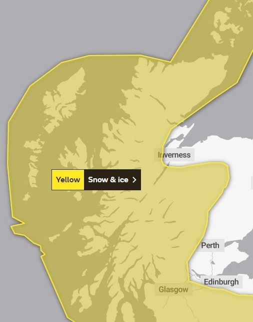
WEATHER forecasters have warned Highland motorists to take care after they extended the area covered by a snow and ice warning to cover most of the Highlands and Islands.
A Met Office yellow warning came into force at 9pm on Christmas Day and will remain in place until 6pm on Boxing Day.
The initial warning covered large chunks of the Highlands, but on Christmas morning this was extended to cover the entirety of the Hebrides, Orkney and Shetland, as well as all western coastal parts of the Highlands - areas which had not been part of the original alert.
Announcing the extension to the area covered by the snow and cie warning, the Met Office said this was done due to the "greater ice risk across western Scotland later in the night".
Read more: White Christmas possible after warning issued by Met Office
On the mainland, the area now covered by the warning encompasses all of Caithness, all of Sutherland, most of Ross-shire and Inverness-shire, the Cairngorm National Park, all of Argyll & Bute, much of Moray, Perthshire, Dumfries & Galloway and the Borders. Areas also affected include Glasgow and parts of the central belt, and western parts of Angus and Aberdeenshire.
A Met Office spokesman said: "Strengthening west-northwesterly winds will bring increasingly frequent wintry showers to parts of Scotland through Sunday night and into Monday morning.
"These may fall as snow to low levels for a time where temporary accumulations of 1-3 cm are possible, with 5-10 cm of snow over the hills. Icy surfaces will be an additional hazard, especially across parts of Western Scotland later in the night where showers will fall as rain or sleet.
"Snow showers will extend to central and southern parts of Scotland by Monday morning, although any lying snow will be confined to higher ground.
"Wintry showers will continue elsewhere within the warning area through Monday; a further 10 cm of snow is possible by the end of the day across higher parts of Highland.
"Strong and gusty winds will bring the risk of drifting and blizzards for upland areas, with a small risk of isolated power outages as the snow and strong wind affects power lines."